PORT MAPPER sp.z o.o. is implementing a project co-financed by European Funds “Port Mapper – a cloud tool for automation and digitalization of measurement services for the coastal zone and sea shores.” POPW.01.01.02-28-0038/21.
The goal of the project is to improve, digitalize, and automate processes related to data collection, result analysis and operational workflows in the coastal zone. Originally focused on enhancing cooperation around measurement and observational activities, the project has evolved into the development of SeaTech — a cloud-based, open-source platform that supports small and medium seaports in managing vessel arrivals, quay scheduling, service planning and day-to-day operational data. SeaTech serves as a modern, publicly available system enabling efficient coordination, data sharing and digital port operations.
Project value: 1,082,111.71 PLN EU co-financing for the project: 864,859.62 PLN
Port Mapper Solutions
The open-source foundation for efficient, automated and transparent port operations.

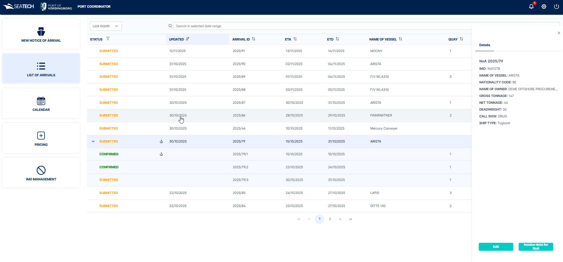
Vessel Arrivals & NoA Workflow
Create, submit and validate Notices of Arrival (NoA) with a structured workflow for agents and port staff. SeaTech automates status changes, notifications and AIS-based arrival detection.

Quay Assignment & Operational Scheduling
Assign quays and bollards using an interactive calendar and port map. Manage overlapping reservations, vessel dimensions and service requirements with complete operational visibility

Flexible Services & Port Dues Management
Configure port services, fees and commodity dues with dynamic pricing rules, intervals and scheduled updates. Automatically generate accurate invoice data for external billing systems

Built-in OPS & Environmental Reporting
Collect operational data needed for shore-power (OPS) reporting, emissions estimates and ESG documentation — helping ports meet regulatory requirements and apply for EU green-energy funding.

Support for Offshore Vessels
SeaTech natively supports offshore service units such as CTVs, enabling accurate scheduling, quay allocation and service planning tailored to offshore operations.

Auto-Updated IMO Blacklist
SeaTech automatically synchronizes an IMO Blacklist, preventing restricted or unwanted vessels from generating NoAs and enhancing port safety and compliance.
About Port Mapper
SeaTech is a software dedicated to empowering small and medium seaports through open-source innovation. With our flagship platform SeaTech, we help port authorities automate vessel arrivals, orchestrate quay and service scheduling, configure pricing and dues, and streamline OPS & ESG-reporting workflows.

Founded with the mission to deliver accessible, scalable and community-driven solutions for the maritime sector, Port Mapper combines maritime-domain expertise, modern cloud architecture and a collaborative open-source ecosystem.
-
Shifting workload to shipping agents ensures that ports only verify data instead of manually entering it.
-
SeaTech enables a fully automated, real-time data flow between shipping agents and port authorities.
-
All services and dues are calculated automatically in real time based on vessel, cargo and assigned operations.
-
Automatic AIS-based arrival/departure detection eliminates manual tracking and reduces operational errors.
Prizes and awards

Our team was awarder by Copernicus Masters Bremmen 2020 Challenge
Port Mapper uses analytical and AI-based algorithms to systematically monitor seashore erosion and the effects of human interference in nature. The Port Mapper projects was awarded because it seeks to fill the gap between the capabilities of Earth observation systems like Copernicus and requirements in mapping coastal habitats using conventional hydrographic methods.
Contact us
Port Mapper team is here for you
If you have any questions contact us via form or direct e-mail:
andrzej.chybicki@inero-software.com
